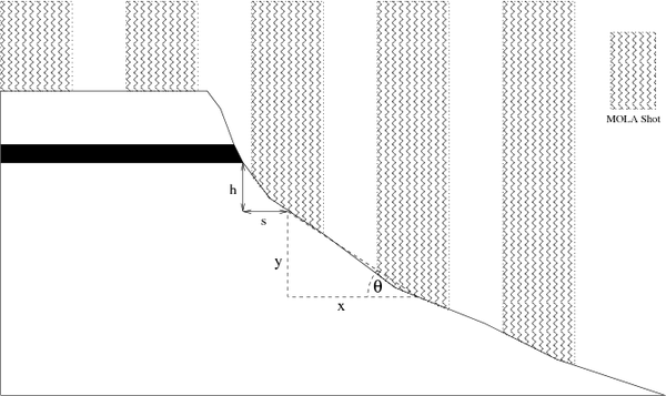
Figure 4: Sketch showing an example cross-section at the top of Eastern Coprates Chasma and the way that MOLA measurements intersect with the surface. It illustrates how we obtain an elevation measurement for the outcrop of the thin dark layer. See Section 2 for an explanation of the symbols.
Return to Layering stratigraphy of eastern Coprates and northern Capri Chasmata, Mars.
A version of this figure was published by Elsevier Inc. Copyright © 2005 Ross A. Beyer.