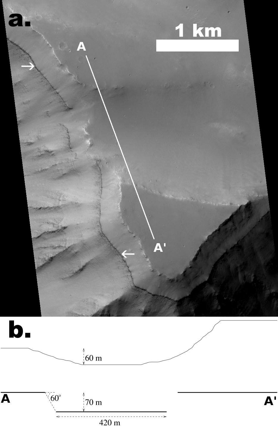
Figure 9: (a) Portion of MOC image E01/02131 showing a closeup of the westernmost flat-topped area shown in Fig. 5a. The white arrows indicate the topmost strong layer. (b) This schematic illustrates the down-dropped block as seen from the west along the A-A' line (top profile is the surface, straight lines below it represent the dark layer). It shows that the dark layer exposed on the western facing slope has a 420 m long segment that is about 70 m in elevation below the level of the majority of the dark layer. Distances and elevations derived from MOC and MOLA data.
Return to Layering stratigraphy of eastern Coprates and northern Capri Chasmata, Mars.
A version of this figure was published by Elsevier Inc. Copyright © 2005 Ross A. Beyer.