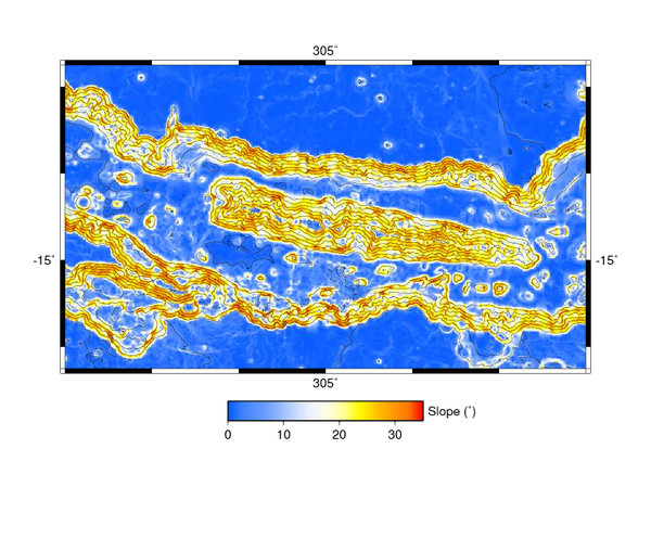
Figure 14: Slope map created from 1/128th degree gridded MOLA data. The elevation contours are every 1000 m.
Return to Layering stratigraphy of eastern Coprates and northern Capri Chasmata, Mars.
A version of this figure was published by Elsevier Inc. Copyright © 2005 Ross A. Beyer.